
BY SUNDIP R. DOSHI
A MEETING OF GREAT MINDS AT STANFORD UNIVERSITY
On September 15, 2018, I traveled to the Bay Area to attend an important meeting of climate scientists, policy makers, universities and companies to discuss the urgent need decision makers and scientists have for better environmental and climate information. Held at Stanford University, Better Metrics for More Effective Decision Making: The Need For A Regionally Based Global Environmental Measurement and Monitoring Network, was as an official affiliate event of the Global Climate Action Summit. The event was co-sponsored by the International Photonics Advocacy Coalition, Stanford Photonics Research Center and the Optical Society of America. To say this was a meeting of great minds is an understatement. The participants and speakers were some of the top minds in science and climate and I was truly honored to be invited.
Dr. Thomas Baer, Chairman of the International Photonics Advocacy Coalition Steering Committee and Director, Stanford Photonics Research Center (and AerNos advisor), was one of the visionaries behind this event, which brought together an interdisciplinary group representing academia, government, regulatory agencies, industry, NGOs and prominent scientists who all have a common goal of curbing greenhouse gas (GHG) emissions and reducing the human and environmental toll of climate change.
IMPROVING CLIMATE DATA AND MODELING
In addition to having a high-level discussion about challenges in climate related policy, modeling and measurement, a key goal of the meeting was to jumpstart the creation of a global network of regional centers focused on improving climate data and modeling. It was reassuring to see firsthand the commitment (and intellectual firepower) of people who have made it their life work to overcome the extraordinary challenges that come with trying to understand – at a global, national, regional, local and hyper-local level – what GHGs we are emitting, what can we do about it and what are the implications of the earth’s natural responses to warming.
THE LIMITATIONS SCIENTISTS FACE
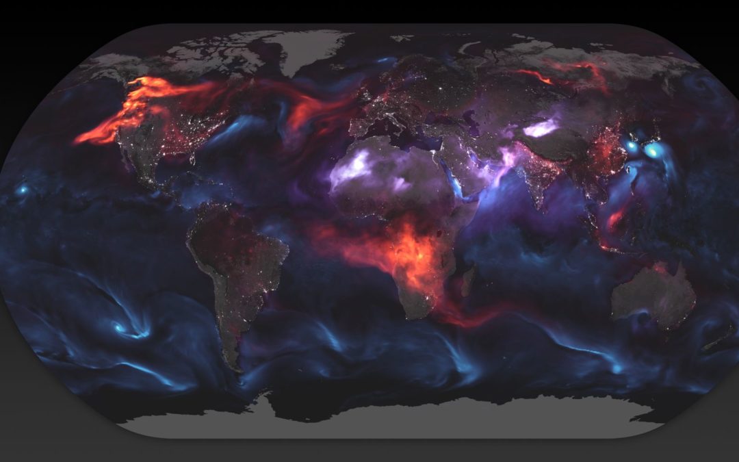
While the topic is of course incredibly serious, I am a geek at heart and was fascinated by the science when the presentations turned to the measurement and modeling technologies used by top scientists. On the day of the event a satellite with sophisticated new measurement technology was sent into orbit and a future launch was announced by the Governor of California. While the satellite-based technologies are incredible and incredibly important for measuring global emissions at a high level, I heard a lot about the limitations scientists face when they try to work backwards using high-level data from satellites to understand what’s happening at the local level back on earth.
ACTIONABLE DATA AT A GRANULAR LEVEL
Dr. Anna Michalak, with Carnegie Institution for Science and Stanford University, painted a clear picture when she explained the challenge of using remote data from satellites and weather models to try to determine where all the emissions originated from. She explained that it is like handing someone a creamy cup of coffee and asking them to determine where and when the cream was poured into the cup. Why this is so important was driven home throughout the day. Providing actionable data at a granular level is going to be key to understanding and controlling emissions. For example, if a city is implementing a strategy to curb leakage of GHGs into the atmosphere (e.g. from infrastructure, industry, etc.), local surface level monitoring would provide critical historic and real-time data needed to quickly determine the success of these initiatives.
MY TAKEAWAYS
I could go on and on sharing what I learned, but here are a few key takeaways from the day:
There is a strong connection between greenhouse gases and air pollution that affect human health. If we can reduce air pollutants that are harmful to people, we will be reducing pollutants that cause warming. It is going to be critical for individual and collective action, and to quickly determine what is and isn’t working, to have networks of surface level sensors for spatial and temporal granularity. Scientists are constantly challenging themselves to do better, challenging the technologies they are using, the models they are using, the policies they are proposing. Across the board they want better tools so that decisions can be made based on the best scientific data possible. Companies like AerNos are eagerly welcomed to the table and there is an urgency to the search for tools that will help scientists make the best recommendations possible to policy makers.
AERNOS | MEANINGFUL | DENSITY | DATA | METRICS
Here at AerNos we build small, multi-gas sensors that enable smart decisions with actionable granular data. It was so validating to hear from these experts that what AerNos is doing will make a meaningful difference in our planet’s and human health.